Mt Hilong Hilong, locally known as Ilong Ilong which means nose in Cebuano because of its nose-like peak as viewed from afar is the highest mountain in CARAGA Region with an altitude at around 2100 MASL. This mountain was rarely known among mountaineering circles because hiking was forbidden here due secessionist struggles and thus it was believed to be the lairs of New Peoples Army for years. Now, Mt Hilong Hilong is slowly becoming a popular hiking destination in Northern Mindanao and its neighboring provinces. Thanks to the effort of Sir Fredgie Dacera, the City Sports Coordinator of Cabadbaran City, Agusan del Norte, this mountain once again caters outdoors and hiking enthusiasts to climb its tough terrain, alluring peaks, death defying ridges and majestic waterfalls.
 |
| A rainy morning at Brgy Mahaba, Cabadbaran City (jump-off) |
A few years ago, I got an interest in climbing our country's highest mountain by each region which my High Conquerors buddy Emmanuel "Jack Sparrow" David dubbed as "The Sweet 16", the highest in the Philippines' 16 Regions. This mountain was part of my wishlist but I only got one climb account via Multiply Site (Sheryl's World dated on the year 2008). The mountain information where never disclosed therefore scaling this mountain remains a wish for sometime. Fast-forward to 2014, Emman David visited Cabadbaran City, his Father's hometown. Doing his little research, he finally got the information we needed... and the climb was set, Holy Week 2015.
 |
| High Conquerors at the jump-off waiting shed |
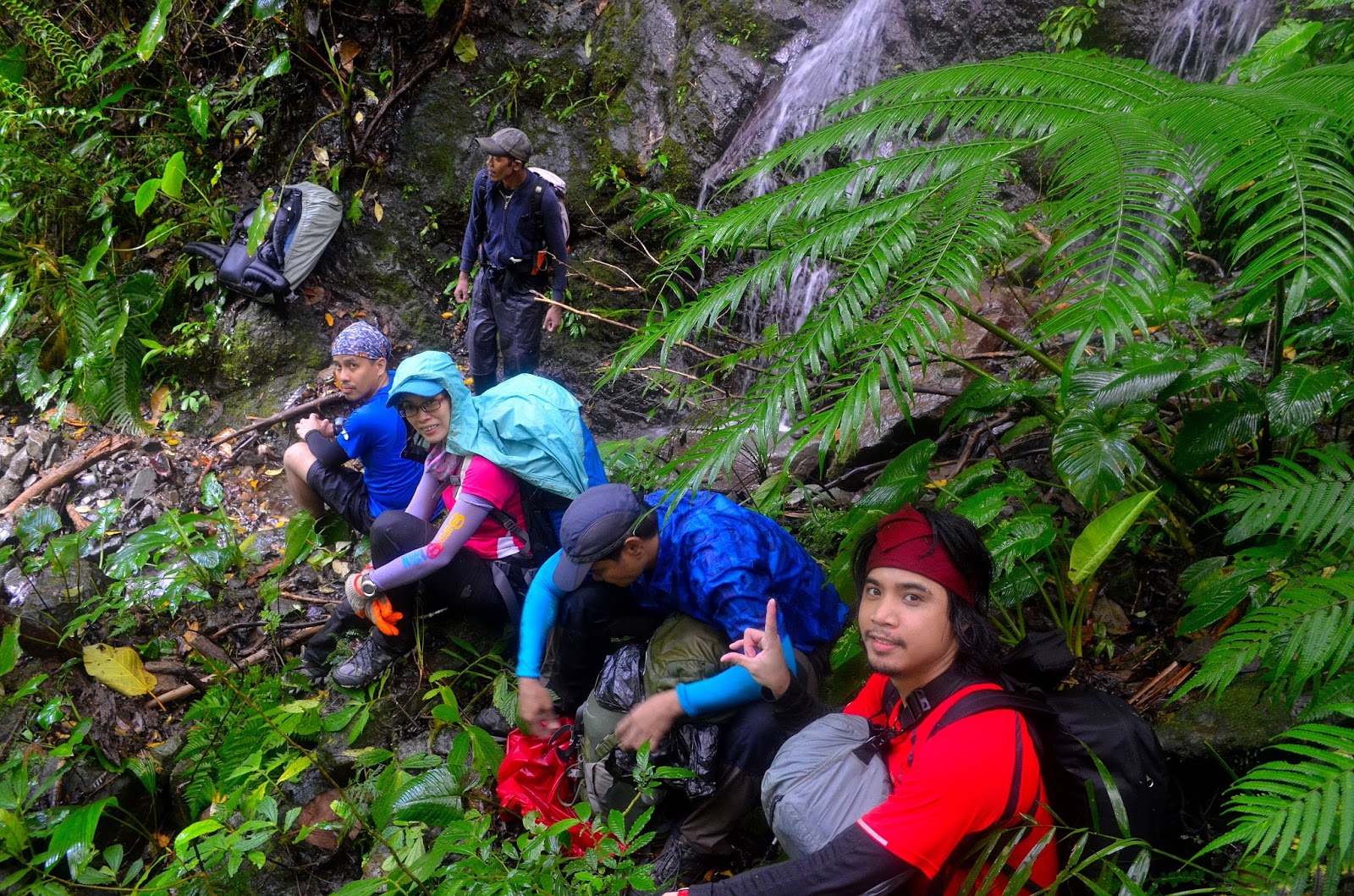
Day 1- Wet and Wild!
We were greeted with an early morning drizzles as we drove our way to the jump-off via Habal Habal. The rain started pouring hard as we were about to start our trek and it continued the rest of day. This is how the Mt Hilong Hilong mountain god welcomes us.The trail? A lot of river crossing, river trekking and mini-water falls crossing. The rocks are slippery, the assaults are steep and muddy with a lot of one miss you die sections.Water falls are also abundant... reminiscing of Mt Candalaga in Compostela Valley. After the river, we passed by an abandoned mining site then we climbed into an unexplored trail up to our first campsite just below the Peak 3. To wrapped up our 1st day... it is a tough 10 hours climb in a non-stop rain!
 |
| River Crossing |
 |
| Slippery Rocky Trail |
 |
| Twin Falls |
 |
| Take 5 along after the mini-falls crossing |
'Day 2- The Peak 3 Surprise
It rained the whole night until early morning. Our second day was no difference from our first day, the environs were always foggy, misty and the rain just won't stop. We actually prepared our breakfast in a non-stop rain. Despite of the rainy situation, I can't resist on pulling my camera out and captured the captivating views as the mist, fog and the rain momentarily stopped.
 |
| Campsite photo ops... a very rare opportunity as the rain momentarily stopped. |
There were no established trails from our campsite to Peak 3. We descended and make a half circle climb around the mountain peak passing by a landslide area. We descended again to avoid the landslide then climb up to a very thorny trail.
 |
| Sir Meynard and Sir Mac (behind) at the Peak 3 mossy forest entry point |
 |
| Gbins, at the "ligaw" trail? photo credit to Emmanuel David |
The final assault was unbelievable. I shouted at Sir Marx because I can't find the trail ahead... I was surprised to see him up on the tree! Well, the trees bowed down thus its branches which were covered with very thick moss served us our trail up to the summit.
 |
| Almost there... entrance to Peak 3 |
Our guide told us that we were the first climbers to set foot at Peak 3. We never expected it and nobody told us that Peak 3 was unexplored... What a sweet surprise!
 |
| Gbins can do it! and Jack Sparrow at Peak 3 |
Day 3- A Peak Hopping Day
Everyone was expecting a light hike day 3 as promised by our guide because according to him the trail from our second camp site to the nearest village is well-established. Not really, because our guide told us a brief preview of his life story in this mountain and that they moved in this same place (our 2nd campsite) six or seven years ago to hide from the authorities who suspected them of being a sympathizers to the New People Army. Until then, no one used this trail... I could imagine the overgrown grasses full of thorns and a lot of obstacles because there were a few typhoons that passed by this area a few years ago. I wasn't mistaken, as our 1st and 2nd day were grueling, tiring, suicidal and etc. etc... our third day have more of it! For 5 hours, we were not descending, we were just traversing into several peaks, around 6 peaks if I'm not mistaken, following the very slippery, thorny, death defying with a lot of obstacles sharp ridge-line trail.
 |
| 2nd Campsite |
 |
| Where's the trail? |
 |
| The beauty of 3rd day trail (Photo credit to Emmanuel David) |
After our peak hopping, we descended into a very steep trail that was so muddy and slippery and with almost nothing to hold unto for more than 2 hours until we reach to the end of the forest line. As expected, everybody thought we were already near the river and the village because it looked like we were on flat ground... we're wrong. It took us almost an hour to go down on a Mt Tapulao-like rocky trail all the way to the river. Then our habal habal service pick us up along the way.
 |
| End of the forest line (Photo credit to Emmanuel David) |
Mt Hilong Hilong is one of the toughest mountain to climb in the Philippines. I will be back for sure, to capture your 3 peaks.
Until my next adventure... God Bless!
More Photos...
 |
| mossy tree at Peak 3 |
 |
| High Conquerors... Meynard, Gecarl, Norie, Emman David & Mac (Photo credit to Emman David) |
 |
| at the mossy forest near peak 2 (Photo credit to Emmanuel David) |
 |
| Gbins can do it! |